4,3 km | 5,8 km-effort
jour 3 13 km
Delphine Besace
Utilisateur
Longueur
13,2 km
Altitude max
237 m
Dénivelé positif
304 m
Km-Effort
17,2 km
Altitude min
127 m
Dénivelé négatif
304 m
Boucle
Oui
Date de création :
2024-08-25 19:57:32.349
Dernière modification :
2024-08-25 19:57:34.11
2h15
Difficulté : Facile
Application GPS de randonnée GRATUITE
À propos
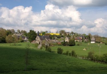
Randonnée Randonnée équestre de 13,2 km à découvrir à Normandie, Calvados, Terres de Druance. Cette randonnée est proposée par Delphine Besace.
Localisation
Pays :
France
Région :
Normandie
Département/Province :
Calvados
Commune :
Terres de Druance
Localité :
Saint-Vigor-des-Mézerets
Départ:(Dec)
Départ:(UTM)
674942 ; 5418957 (30U) N.
Commentaires
Randonnées à proximité
Le Moulin du Boeuf
A pied
Facile
Terres de Druance,
Normandie,
Calvados,
France
6,1 km | 7,9 km-effort
1h 47min
Oui
Tour du Bourg
A pied
Facile
Terres de Druance,
Normandie,
Calvados,
France
3,3 km | 4,2 km-effort
57min
Oui
A la Découverte des "Fées Baligot"
A pied
Facile
Condé-en-Normandie,
Normandie,
Calvados,
France
10,4 km | 13,6 km-effort
3h 5min
Oui
Vers la "Fosse aux Renards"
A pied
Facile
La Villette,
Normandie,
Calvados,
France
4,5 km | 6,3 km-effort
1h 25min
Oui
Chemins Creux E
A pied
Facile
Condé-en-Normandie,
Normandie,
Calvados,
France
6,6 km | 8,2 km-effort
1h 51min
Oui
Chemins Creux C
A pied
Facile
Périgny,
Normandie,
Calvados,
France
4,2 km | 5,1 km-effort
1h 10min
Oui
Chemins Creux A
A pied
Facile
Pontécoulant,
Normandie,
Calvados,
France
3,8 km | 5,7 km-effort
1h 17min
Oui
Chemins Creux D
A pied
Facile
Condé-en-Normandie,
Normandie,
Calvados,
France
6,9 km | 8,6 km-effort
1h 56min
Oui